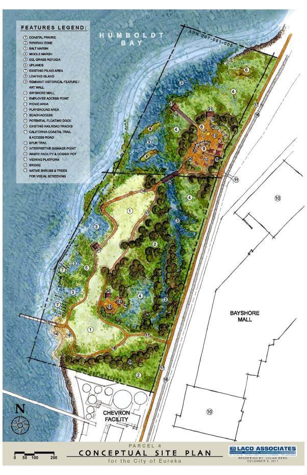
LACO prepared a conceptual site plan for an 18-acre industrial site owned by the City of Eureka (City). The City plans to rehabilitate the site back to a traditional bay estuary, and include areas for interpretive parks and trails. After looking at the historical bay edge habitat, site conditions, and existing historical structures that could be used for interpretive exhibits, our project team developed a watercolor rendering and conceptual site plan based on the City’s preliminary concepts, and incorporated many Low Impact Development (LID) and sustainable design principles including:
- Bio-retention marshes and run-off filtration
- Native habitat creation
- Energy efficient and night-sky friendly lighting
- Locally sourced/low embodied energy materials
- 100% native planting
- Permeable paving
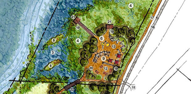
In addition, the plan provides areas for educational exhibits, outdoor recreation, wild-life observation, and bay edge habitat repair by including these features:
- Coastal prairie and upland habitats
- Riparian, salt, and middle marshes
- Multi-use trail that links to California Coastal Trail system
- Interpretive signage points
- Kiosk with habitat and historical context informational signage
- Viewing and bay overlook platforms
- Interpretive art facility
- Playground and picnic areas
- Beach access point
- Floating dock for boating access
The plan we created is currently being used by the City to seek funding sources to complete the project.